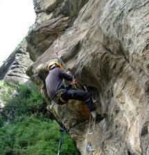
Expedition Peaks
-
 The Western Himalayan region, offers various possibilities of climbing mountains above 6000 metres in Himachal & Ladakh region. Yeti Travels based in the “Valley of GOD” in Himachal Pradesh. We offer you total ground logistic support for the mountaineering expeditions to make your expedition successfully. Our team of expert qualified mountaineers guides who have successfully climbed many peaks in the region of the Himalayas. Climbing peaks in the Indian Himalayas climbers have to require the authorization of the Indian Mountaineering Foundation based in New Delhi. An application form needs to be filled in by the expedition leader with complete details of the proposed expedition. This application contains certain conditions including the exact route to be followed, the name of the peak proposed to be climbed, the kind of photographic and wireless equipment being used and other details. It is also mandatory for a Liaison Officer appointed by the I M F to accompany the expedition.
 We suggests that all expedition teams plan their expeditions accurately as any changes after the application has been submitted we will involve unnecessary delay of more than a month in processing. Please carefully go through the brochure published by the Indian Mountaineering Foundation and collect all relevant data and information required by the team in advance. Peaks and expeditions can be booked by the leader of the expedition. Please attach all specified documents along with the application so that processing can be done well in time for the expedition date. Also ensure that the application reaches the I M F at least three months in advance from the starting date of the planned expedition. Please note some of the following points while planning your expedition: Members are required to have adequate insurance in case rescue and evacuation becomes necessary by helicopter.
We can provide all camp staff, porters etc after due consultation with the I M F. We shall also mail you a list of all the documentation required for booking a peak and the exact charges that will be payable to the I M F according to the height of the peak to be attempted. While planning your expedition you can rest assured that we will provide all the necessary help required after your permits have been sanctioned by the Government of India / Indian Mountaineering Foundation.
Peak
Height
Longitude
Latitude
Route
Reo Purgyil
6816m
78°74’
31°88’
Kullu –Rampur-Kinnaur (Nako Village-BC, CI ,CII, ABC & Summit attempt.
Alirathni-tibba
5470m
77° 26'
32° 05'
Kulu (RH)- Malana- BC,C-I, C-II and Summit attempt.
Stok Kangri
6153m
77°26’32’’
33°59’11’’
Manali-Kelong Sarchu-Leh-Stok Village-Summit Three Days Approach from Base Camp.
White Sail (Dharamsura)
6420m
77° 34'
32° 12'
Kulu (RH) Manikaran (RH)- Tos (Vill)- Shamshi-Sari-BC-ABC-C-I
CB-10 (Tara Pahar)
6227m
77° 29'
32° 27'
Manali- Chhatru-Chhota Dara-Bata (RH)- BC-C-I, C-II & summit attempt.
CB-11
5955m
77° 31
32° 23'
-do-
CB-12
6258m
77° 33'
32° 20'
-do-
CB-13
6264m
77° 33'
32° 21'
-do-
CB-14
6078m
77° 34'
32° 22'
-do-
Deo Tibba
6001m
77° 23'
32° 11'
Manali (RH)- Jagatsukh (RH)- Chhika-Seri-Tainta (BC)-C-I, C-II (Duhangan Col), C-III and Summit attempt.
Devachan
6100m
77° 33'
32° 14'
Kulu-Manikaran (RH)- Tos Saram-Base Camp -C-I-C-II
Hanuman Tibba
5932m
77° 02'
32° 21'
Manali-Solang-Dhundi (RH) - Beas Kund (BC) - ABC- C-I, C-II, C-III and Summit attempt.
Laddakhi
5536m
77° 02'
32° 23'
Manali-Palchan-Dhundi (RH) - Beas Kund (BC)-C-I and Summit attempt
Shitidhar
5289m
77° 01'
32° 22'
-do-
Friendship
5340m
do
do
Indra San
6223m
77° 24'
32° 12'
Manali (RH)- Jagatsukh-Chhika-Seri-Tainta (BC)
Kharcha Parabat
6270m
77° 37'
32° 19
Manali-Batal (RH)-BC-ABC-C-I_Summit Camp and attempt to Summit.
Kharcha Parabat
6270m
77° 37'
32° 19
Manali-Batal (RH)-BC-ABC-C-I_Summit Camp and attempt to Summit.
Makerbeh
6069m
77° 04'
32° 25'
Manali-Palchan-Dhundi (RH)- Beas Kund (BC)-C-I, C-II,C-III and Summit attempt.
Manali
5640m
77° 03'
32° 24'
Dhundi (RH)- Beas Kund (BC)-C-I, C-II and Summit attempt.
Menthosa
6443m
76° 42'
32° 55'
Manali-Rohtang pass- Tandi-Udhaipur (RH)- Miyar Nallah-Urgos (Vill (last Vill,C-I, C-II and Summit attempt.
Papsura
6440m
77° 33'
32° 12'
Manali (RH)- Manikkaran (RH)- Tos-Saram-BC-ABC-C-I
Shikarbeh
6100m
77° 03'
32° 26'
Dhundi (RH)- Beas Kund (BC)-C-I, C-II and Summit attempt.